
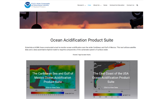
offers tools to monitor ocean acidification over the wider Caribbean and Gulf of America, utilizing satellite data and a data-assimilative hybrid model to map the components of the carbonate system of surface water.
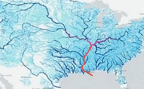
is a hydrologic modelling framework that simulates observed and forecast streamflow over the entire continental U.S. at a very fine spatial and temporal scale.
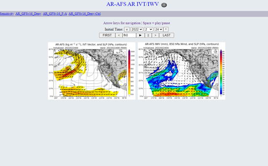
is a high-resolution regional model for real-time forecasts of atmospheric rivers (weather phenomena that drive heavy rain events that often cause floods) for Northeast Pacific and Western North America.
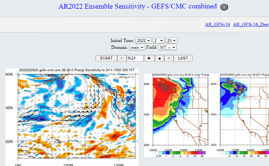
informs decision-making when planning for reconnaissance missions by identifying and suggesting areas for data collection flight paths.
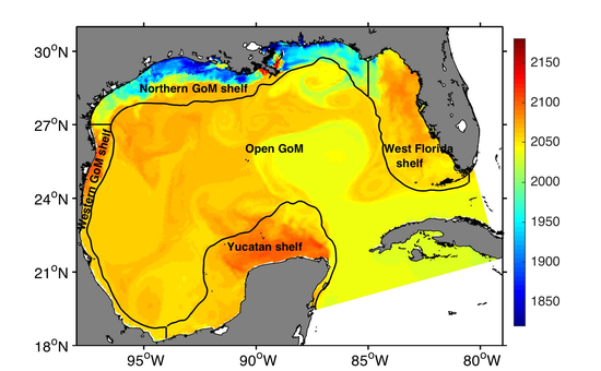
contains surface patterns of temperature, salinity, total alkalinity, and dissolved inorganic carbon from 1981 to 2014 using the GoMBio model, a ROMS-based 8-km resolution ocean-biogeochemical model for the entire Gulf of America.