NGI Data Support to NOAA Ocean Research, Conservation, and Restoration
December 18, 2024

Colorful web code on a computer monitor. Credit Markus Spiske on Unsplash.com (Skf7HxARcoc).
Every month, the National Centers for Environmental Information (NCEI) with the National Oceanic and Atmospheric Administration (NOAA) archives more than 229 terabytes of oceanic, atmospheric, and geophysical data from over 130 observation platforms. For these data to be useful to current and future research and science-based decisions, strategic management from collection to archival is necessary.
The Northern Gulf Institute (NGI) supports NCEI with expertise in data management and stewardship focused on long-term data quality, safety, accessibility, and usability. NGI scientists, engineers, and specialists apply mathematics, statistics, artificial intelligence, computer engineering, and subject matter knowledge to organize, extract value from, communicate, and save data using techniques, pipelines, workflows, visualizations, and repositories supported by high performance computing with supercomputer systems at Mississippi State University that rank as some of the most powerful in the world and fastest in U.S. academia.
Below are NGI data management projects, led by NGI Co-Director Dr. Paul Mickle, that supported NOAA in 2024.

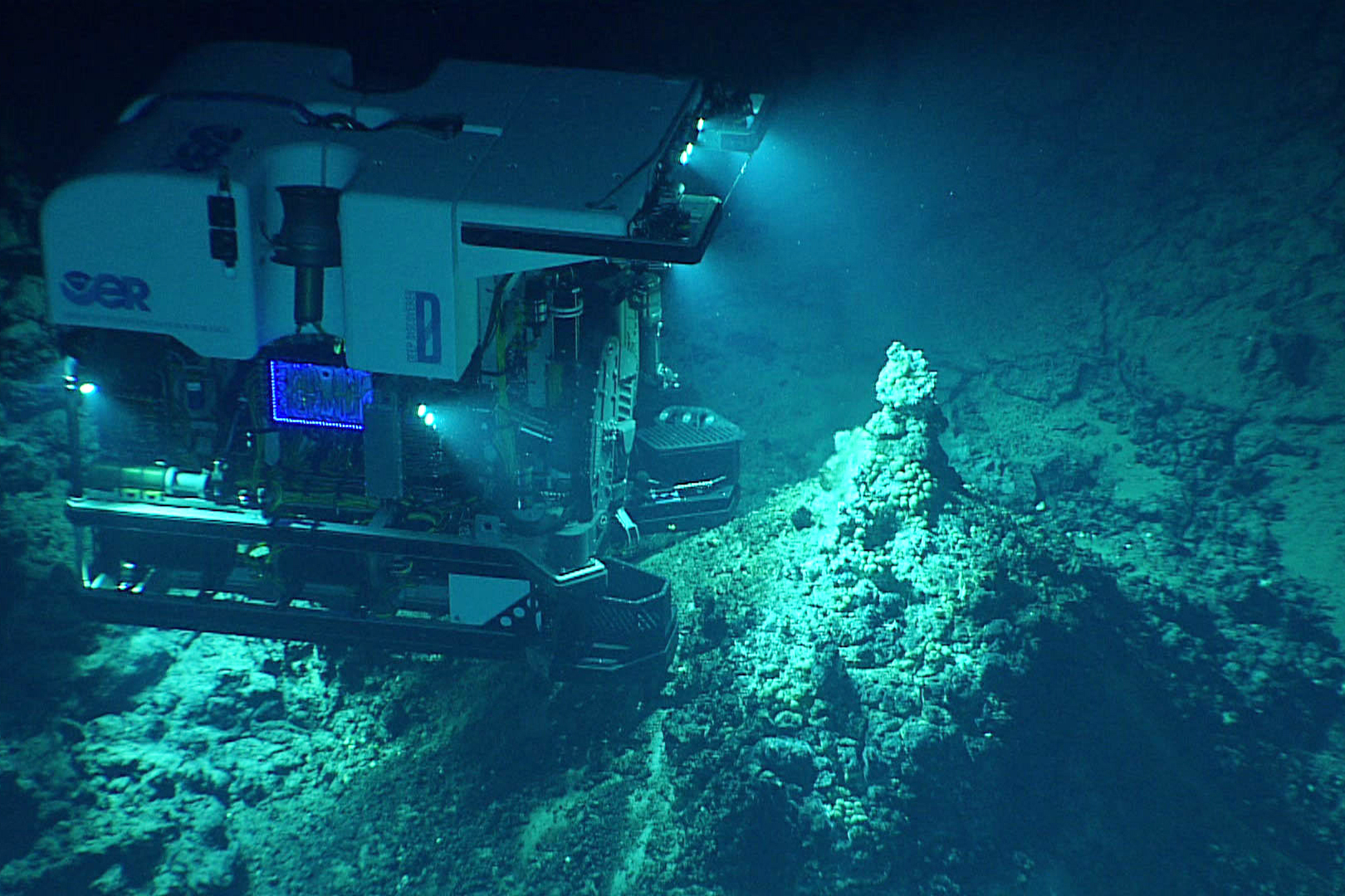
ROV Deep Discoverer takes images of a newly discovered hydrothermal vent field at Chammoro Seamount. Credit: NOAA Office of Ocean Exploration and Research, 2016 Deepwater Exploration of the Marianas.
This project provides data support for NOAA's OER program and its deep ocean exploration vessel Okeanos Explorer, the only federal vessel dedicated to exploring the ocean for knowledge, discovery, and advancement.
In 2024, NGI produced a Data Stewardship Portfolio to guide OER data assets management and an operations manual for the vessel's Sampling Operations Database Applications (SODA). These publications assist new staff onboarding and facilitate collaborative efforts between NGI and NCEI and across multiple NOAA teams.
NGI created workflow diagrams for the vessel's data transfer pipelines to track and identify processing bottlenecks for targeted refinement and streamlined updates to landing pages for OER cruise and dive websites. The team supported at-sea data managers during two sampling missions, deployed and maintained the SODA for ROV missions, and managed the ingestion of museum curation results into the SODA and the
OER Data Atlas. Also, landing pages for OER-funded opportunities and awards were updated, data management training was provided to staff, and a variety of OER documents were processed for 508 compliance and repository archival. Non-restricted OER data and products are available in
online portals.
In a broader effort, NGI collaborates across the NOAA OER teams and Mesophotic Deep Benthic Communities (MDBC) Restoration teams to design one cloud-based, at-sea database management tool with flexibility to handle data collected for both projects and other NCEI projects, essentially merging the functionalities of two databases into a non-access limited data and metadata collection tool.
The NGI team includes Susan Gottfried, Jennifer Green, Jeanne-Marie Havrylkoff, Madalyn Newman, and Robbie Ward. Partners include the Cooperative Institute for Satellite Earth System Studies (CISESS), Cooperative Institute for Research in Environmental Sciences (CIRES), and the Global Foundation for Ocean Exploration (GFOE). This effort supports NESDIS and OMAO missions.

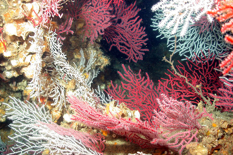
A deep-sea coral garden in Madison-Swanson Marine Reserve off the Florida coast, protected in 2000. Credit: NOAA Office of Ocean Exploration and Research and the National Undersea Research Center at the University of North Carolina, Wilmington.
This project provides data support for the Office of Habitat Conservation's DSCRTP and the
National Database for Deep-Sea Corals and Sponges, the most comprehensive database of deep-sea corals and sponges in U.S. waters.
In 2024, NGI maintained the existing and developed a new web portal for the national database and completed quarterly data releases to it and
Deep-Sea Coral & Sponge Map Portal. The team created scripts for QA/QC on large-volume datasets to prepare and package them for archival, automated the maintenance and update of
DSCRTP website content, and processed all known data from DSCRTP-funded research for archival. To facilitate inclusion of other coral data sources in the national database, NGI serves in a consulting role for the Office of Response and Restoration's project titled, Mesophotic and Deep Benthic Communities Restoration. In preparation for a new DSCRTP video archive pipeline, NGI obtained approval of candidate datasets and initiated discussions with NOAA line offices for data submission and archival
The team archived datasets for Alaskan region habitat suitability modeling projects for the
Aleutian Islands and the
Gulf of Alaska; added a new Alaskan region data synthesis product to the NCEI StoryMap,
Characterizing U.S. Deep-Sea Corals and Sponges; and launched two data synthesis projects (1) Contrasting beta diversity patterns for Alaskan deep-sea coral: An analysis of the difference between abundance and presence data and (2) Comparative faunal turnover of co-occurring deep-sea coral, fish, and crustacean megafauna.
The NGI team includes John Cartwright, Robert McGuinn, David Sallis, Arvind Shantharam, and Tiffany Toft. Partners include the Office of Habitat Conservation, Northeast Fisheries Science Center, Northwest Fisheries Science Center, Southwest Fisheries Science Center, Alaska Fisheries Science Center, National Centers for Coastal Ocean Science (NCCOS), and the Office of Response and Restoration. This effort supports NESDIS, NMFS, NOS, and OAR missions.

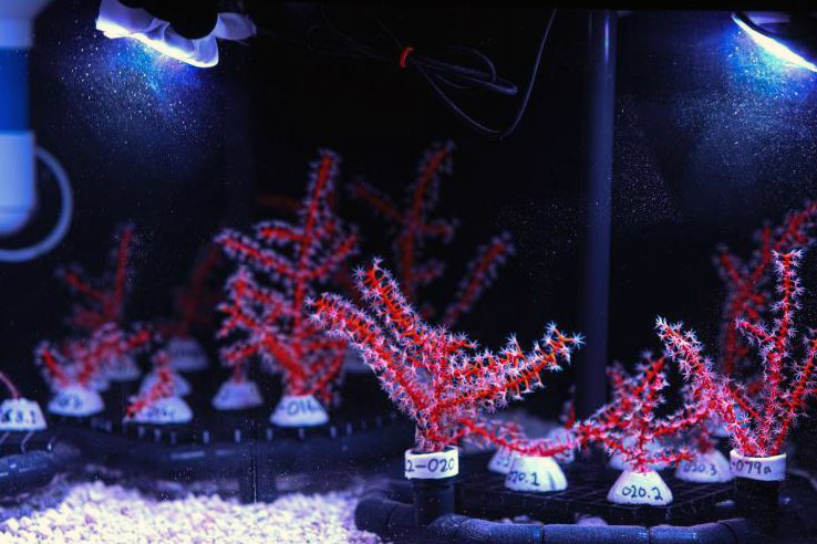
Fragments of the Swiftia exserta sea fan collected in the Gulf of Mexico in June 2022 are arranged in photogrammetry carousels for growth monitoring at the NOAA Hollings Marine Laboratory. Credit: NOAA
Four MDBC research projects focus on the restoration of vital seafloor habitats damaged by the 2010 Deepwater Horizon oil spill 1)
Mapping, Ground-truthing, and Predictive Habitat Modeling, 2)
Habitat Assessment and Evaluation, 3)
Coral Propagation Technique Development, and 4)
Active Management and Protection. Beginning at the planning phase, NGI has been providing data support to MDBC projects, including their ocean observation and monitoring field campaigns, and facilitates data management across the four projects.
In 2024, NGI developed an MDBC organizational scheme and created processes for tracking cruise data, administration of the At-Sea Database (ASDB), and ingestion and archival of data. New techniques resulted in automating the renaming of ROV dive images and organizing files, which were then applied to rename, reprocess, and review data from past cruises. There were 10 MDBC research cruises during 2024, which benefited from NGI programming additional functions for the ASDB that improved user experience and creating a scripted process for manual QA/QC checks of raw data collected at sea.
The team provided training for data content managers to use the Send2NCEI (S2N) metadata generation and data submission tool for NCEI archives. NGI maintains an
MDBC workspace on the Data Integration Visualization Exploration and Reporting (DIVER) Explorer website so MDBC teams can track project progress and store working documents. The team also collaborates with MDBC outreach and education teams to deliver videos, imagery, and real-time data stats during cruises for social media.
NGI formed a working group (the Cross Project Data Management Team or XPD) that includes data managers with the four MDBC projects and NCEI staff. This collaboration helped draft the NCEI Data Management Plan for MDBC, enhanced training for at-sea data management, and is working towards standardizing ocean water sample collection across all vessels and technicians.
The NGI team includes Susan Gottfried, Elijah Hall, Nicole Hoban, Madalyn Newman, Temitope Owoyombo, Errol Ronje, and David Sallis. Partners include NCCOS, NCEI, NMFS, U.S. Geological Society (USGS), Bureau of Ocean Energy Management, and the Ocean Exploration Cooperative Institute. This effort supports NESDIS, NMFS, and OAR missions.

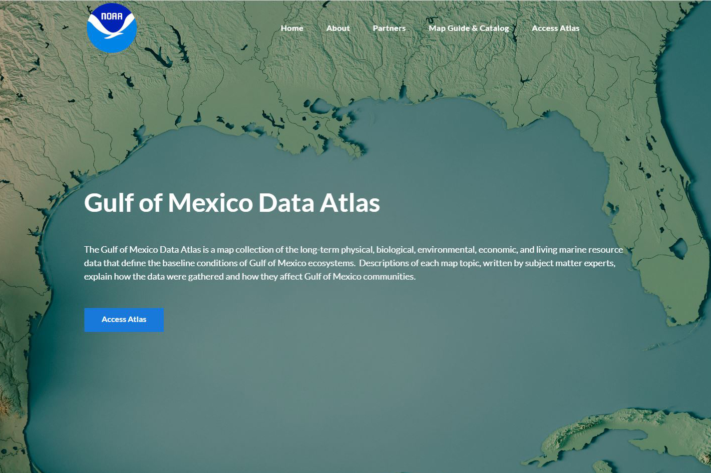
The Gulf of Mexico Data Atlas is a map collection of long-term data that define the baseline conditions of Gulf of Mexico ecosystems. Credit NCEI
Two NGI projects provide ongoing, broad data support for NCEI's information services and data-derived ocean ecosystem products including communications content creation; graphics production; 508 compliance of documents; and training, customer service, outreach, and education to enhance user engagement with NOAA information services and data products.
NGI provides scientific data stewardship for these NCEI information services and products:
NGI's program office hosts an
Okeanos Explorer Exploration Command Center (ECC) that allows scientists to participate remotely as expeditions are underway. The ECC includes computing systems for live webcasts, high-definition video streams, and two-way communications.
The NGI team includes Barbara Ambrose, Clint Edrington, Susan Gottfried, Jonathan Jackson, Yee Lau, Robert McGuinn, David Moffitt, Madalyn Newman, Ebenezer Nyadjro, David Sallis, Arvind Shantharam, Robbie Ward, and Ana Wheeler. Partners include the Atlantic Oceanographic and Meteorological Laboratory (AOML), MDBC, NCCOS, NMFS, OER, OMAO, NOAA's Deep Corals group, Cooperative Institute for Earth System Research and Data Science (CIESRDS), Cooperative Institute for Marine and Atmospheric studies (CIMEAS), and Cooperative Institute for Satellite Earth System Studies (CISESS). Collaborators include Ocean Networks Canada, NOAA Great Lakes Regional Collaboration Team, Michigan Department of Natural Resources, USGS, U.S. Fish and Wildlife Service, and the Marine Sanctuary Association. These efforts support NESDIS, NMFS, NOS, OAR, and OMAO missions.
**********
The
Northern Gulf Institute is a NOAA Cooperative Institute with six academic institutions located across the US Gulf Coast states that conducts research and outreach on the interconnections among Gulf of Mexico ecosystems for informed decision making.
By
Nilde Maggie Dannreuther with the Northern Gulf Institute, Mississippi State University.


